Blog
Flooding in Auburn WA: Causes, Risks, Safety Tips, and How to Prepare

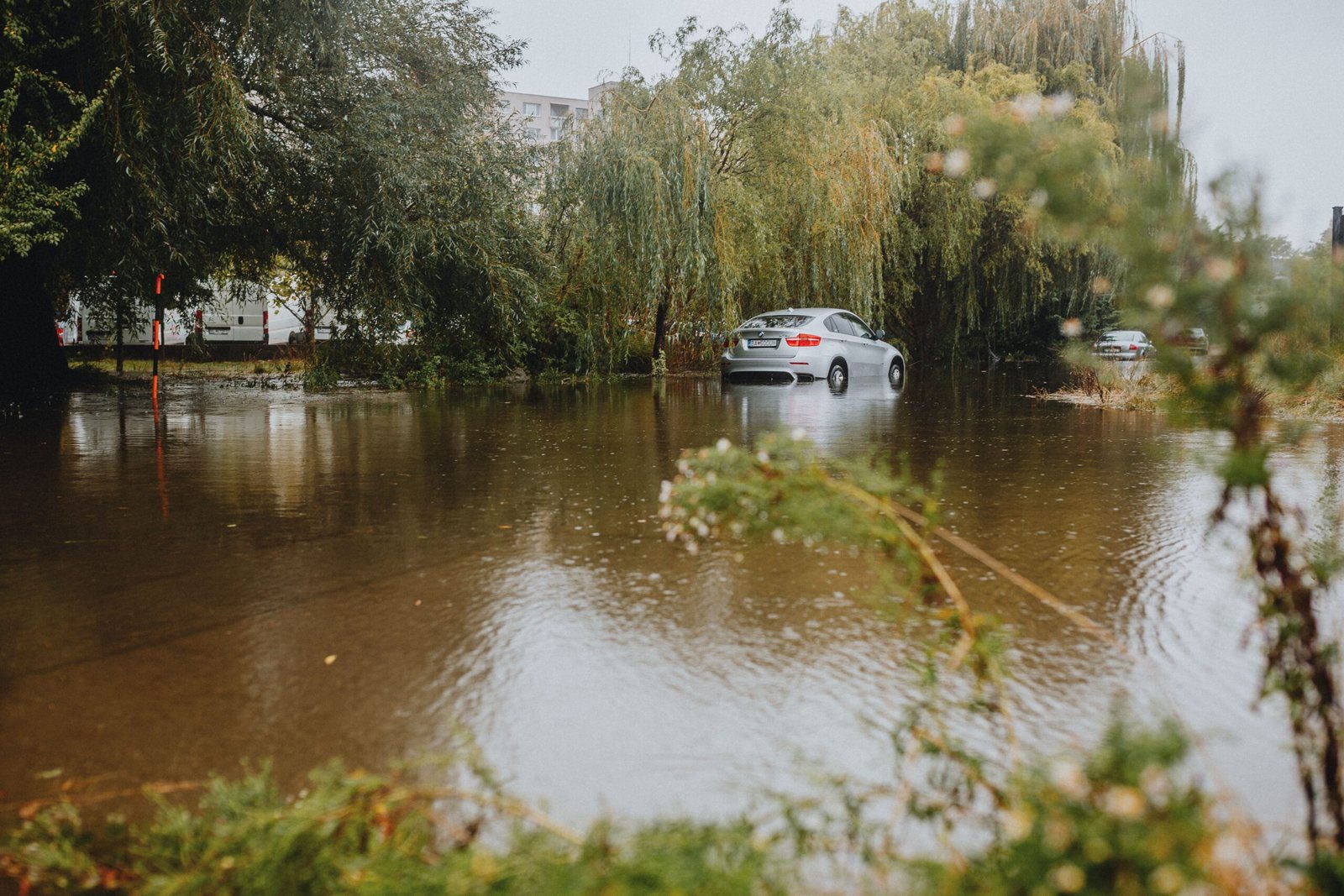

Flooding in Auburn WA is an important concern for residents, homeowners, renters, businesses, and anyone traveling through the area during periods of heavy rain. Auburn’s location near the Green and White Rivers means that river flooding can become a serious issue during major precipitation events, while intense rainfall can also create localized stormwater flooding in streets and lower-lying areas. The City of Auburn explains that flooding in the region can be influenced by a combination of heavy rainfall and snowmelt from the Cascade Mountains, while localized flooding can also occur when stormwater runoff exceeds drainage capacity.
Flooding does not necessarily mean that every part of Auburn will experience standing water at the same time. Conditions can vary considerably depending on elevation, proximity to rivers and drainage channels, rainfall intensity, soil saturation, stormwater infrastructure, and the operation of regional flood-control systems. The city states that the Green and White Rivers are central to Auburn’s flood risk and that higher flood stages can affect broader areas, while heavy precipitation can also cause localized urban flooding. Understanding these differences is important because preparation should not begin only after water has already started rising. Knowing your risk, receiving emergency alerts, preparing an evacuation route, protecting important belongings, and understanding how to respond to floodwater can significantly improve safety.
Why Does Flooding Happen in Auburn WA?
One of the main reasons flooding in Auburn WA deserves attention is the city’s relationship with two major river systems. According to the City of Auburn, flooding can occur along the Green and White Rivers, particularly when heavy rainfall combines with runoff from melting snow in the Cascade Mountains. Although dams and other flood-control infrastructure reduce the likelihood and severity of some flooding, those systems cannot eliminate flood risk completely. Extremely wet conditions can still create dangerous situations, particularly when rivers are already elevated and additional rainfall continues to enter the watershed.
Auburn can also experience flooding that is not directly caused by a river overflowing its banks. During periods of intense rainfall, stormwater can accumulate rapidly when drainage systems cannot move water away quickly enough. Streets, parking areas, yards, basements, underpasses, and other low points can collect water even when the nearest river is not overflowing. This is one reason residents should pay attention to both river flood warnings and local weather conditions. King County notes that urban flooding can create transportation problems and affect residential and business properties, meaning that flood risk is not limited exclusively to properties located immediately beside a river.
Green River and White River Flood Risk in Auburn
The Green River and White River are central to understanding Auburn’s flood environment. King County identifies the Green River as one of the major river systems flowing through the county, and its flood services include monitoring and warning resources for river conditions. The county specifically provides information for the Green River near Auburn, including river gauge data that can help residents understand changing conditions.
Flood-control infrastructure has reduced the historical frequency and severity of some flooding in the Auburn area. The City of Auburn explains that the Howard A. Hanson Dam on the Green River and Mud Mountain Dam on the White River, along with levees and other flood-management measures, play an important role in reducing flood risk. However, the city also emphasizes that major rainfall events can exceed the protection provided by dams and levees. This means residents should not assume that a property is permanently safe simply because it has not flooded in recent years.
Recent flood-management work also demonstrates why continued preparedness matters. Following the historic December 2025 flooding, the King County Flood Control District reported emergency projects involving flood protection infrastructure around the White River and Auburn, including work near the Oravetz School Revetment and Roegner Park. These projects are examples of how local agencies continue strengthening flood protection, but individual residents still need their own household and business preparedness plans.
When Is Flooding in Auburn WA Most Likely?
The City of Auburn states that most flooding historically occurs during the winter months, typically from November through February. This seasonal pattern is connected to periods of heavier precipitation and mountain snow conditions, although flooding can occur outside the traditional winter period when weather conditions produce sufficient rainfall or runoff.
Residents should therefore be particularly attentive during extended periods of heavy rain. A single short rainstorm may not create significant flooding, but several days of persistent precipitation can saturate the ground and increase runoff into rivers and drainage systems. When heavy rainfall combines with snowmelt, river levels can rise more quickly and remain elevated for longer periods. This is why checking official warnings during prolonged wet weather is more useful than relying only on whether water is currently visible near your property.
How to Check Flood Risk in Auburn WA
If you live in Auburn, one of the most useful things you can do is determine whether your home or business is located within or near a designated flood-prone area. The City of Auburn provides floodplain information, while King County provides mapping and flood-risk resources. King County recommends using its mapping tools and FEMA’s Flood Map Service Center to investigate floodplain boundaries and understand potential exposure.
It is important to understand that flood maps are not simply a record of where water has recently appeared. A property may be located within a FEMA floodplain even if the owner has never personally experienced flooding there. Auburn explains that floodplain designations use information such as ground elevations and historical rainfall data to estimate where water could go under specified scenarios. Checking the risk before an emergency occurs gives homeowners much more time to make practical decisions about insurance, drainage, property improvements, emergency supplies, and evacuation planning.
How to Prepare for Flooding in Auburn WA
Preparing for Auburn WA flooding should begin well before a warning is issued. Start by creating a household emergency plan that includes several ways to leave the area and a predetermined meeting location on higher ground. Every member of the household should know how to receive emergency alerts and what to do if authorities issue an evacuation recommendation. Auburn also recommends having emergency supplies sufficient for an extended disruption and preparing to shelter in place if necessary.
Protecting property is another important part of flood preparation. Vehicles, outdoor equipment, valuables, important documents, and other items that can be moved should be relocated to higher areas when flooding is anticipated. Items stored in basements or on lower floors should be moved upward when possible. Residents should also keep storm drains and drainage areas clear of leaves, trash, and other debris. King County specifically recommends maintaining street drains and storm grates and learning how to use sandbags where appropriate.
Flood insurance is also worth considering because ordinary homeowners or renters insurance may not provide the type of flood coverage many people assume they have. King County recommends flood insurance for homeowners and renters seeking protection against flood-related losses. Anyone considering a policy should review exactly what the policy covers, including building structures, contents, deductibles, exclusions, and waiting periods, rather than waiting until a storm is approaching.
What to Do During a Flood
When flooding in Auburn WA becomes an active threat, personal safety should take priority over property. Follow instructions from emergency officials and monitor reliable local sources for changing conditions. If authorities tell residents to evacuate, leaving early is generally safer than waiting until roads are surrounded by water or evacuation routes become difficult to use. Auburn recommends evacuating toward higher elevations and following designated safety instructions.
Never walk or drive through floodwater simply because the water appears shallow. Moving water can be deceptively powerful, and submerged roads may contain damaged pavement, debris, open drainage structures, electrical hazards, or other dangers that cannot be seen from the surface. King County explicitly advises people not to walk, wade, or drive through flooded areas and emphasizes turning around rather than attempting to cross dangerous water. If you become trapped inside a building by rapidly rising water, call 911 and move to a safer higher level if possible.
Electricity creates an additional hazard during flooding. Do not touch electrical equipment while standing in water, and avoid downed power lines. Auburn advises residents to stay away from downed lines and to turn utilities off if their home is flooded, following appropriate safety procedures and official guidance. If you are unsure whether electrical systems, gas appliances, or structural components are safe after flooding, wait for qualified professionals or emergency officials to provide guidance.
What to Do After Flooding
Flood danger does not automatically disappear when rainfall stops. Water may remain in low-lying areas, river levels can stay elevated, and buildings can contain hidden electrical, structural, or contamination hazards. Before entering a flooded building, check for obvious structural damage and be especially cautious around electricity and gas. King County recommends using flashlights rather than open flames when entering a building because gas leaks may be present.
Documentation is also important after a flood. Photograph damaged rooms, furniture, appliances, vehicles, walls, floors, and other property before extensive cleanup begins whenever it is safe to do so. Keep records of repair expenses and contact your insurance provider as soon as possible to understand the claims process. King County recommends documenting the high-water mark, photographing damage, and keeping records of repair costs.
Water damage can quickly lead to additional problems if wet materials are not properly dried and treated. Depending on the severity of the flooding, homeowners may need professional water extraction, drying, structural assessment, electrical inspection, or mold remediation. In Auburn, residents can find local restoration providers such as 24/7 Flood & Fire, SERVPRO of Auburn/Enumclaw, and Restoration Medix LLC. These are examples of local services to research rather than endorsements; homeowners should compare qualifications, availability, estimates, insurance handling, and customer reviews before hiring a contractor.
Flood Alerts and Emergency Information
One of the simplest ways to improve flood preparedness is to receive warnings before conditions become dangerous. King County provides flood alerts for rivers and creeks and also offers a flood warning app for monitoring changing river conditions. These resources can be particularly valuable during extended periods of heavy rain when river levels may change over time.
For an active emergency, residents should rely on official emergency instructions rather than social media rumors or unverified posts. The King County Flood Control District states that emergency flood events should be reported through 911, while its flood-warning resources provide information for non-emergency active flood situations. Having alerts enabled before the next major storm can give residents valuable time to move belongings, relocate vehicles, prepare family members, and evacuate if necessary.
How Homeowners Can Reduce Flood Damage
Homeowners cannot completely eliminate flood risk, but they can take steps to reduce potential damage. Depending on the property and flood zone, possible measures include improving drainage, protecting basement openings, elevating vulnerable equipment, installing appropriate flood-resistant improvements, and keeping important belongings above expected water levels. Auburn’s floodplain guidance also points property owners toward measures such as elevating structures and retrofitting homes to reduce future flood damage.
The best flood-mitigation strategy depends on the specific property. A house near a river may have different vulnerabilities from a home that primarily faces stormwater runoff. Before investing significant money in modifications, homeowners should determine the property’s flood exposure, understand applicable local regulations, and consult qualified professionals when structural changes are being considered.
Why Flood Preparedness Matters for Auburn Residents
The biggest mistake people can make regarding flooding in Auburn WA is assuming that because their neighborhood has not flooded recently, it cannot flood in the future. Flood-control infrastructure significantly reduces risk, but it does not make flooding impossible. Auburn’s own floodplain guidance emphasizes that significant rainfall can exceed the protection provided by dams and levees and that properties can remain at risk even when they have not experienced recent flooding.
Preparedness is therefore not about expecting a disaster every time it rains. It is about having a sensible plan before one occurs. Knowing your flood zone, subscribing to alerts, maintaining emergency supplies, understanding evacuation routes, protecting important documents, reviewing insurance, and knowing how to respond to floodwater can all reduce confusion when conditions deteriorate. Good preparation can make a major difference for families, businesses, and property owners.
Conclusion
Flooding in Auburn WA is a real but manageable community risk that requires awareness and preparation. Auburn’s position near the Green and White Rivers, combined with heavy rainfall, snowmelt, and localized stormwater runoff, means that different parts of the city can experience different types of flooding. Local dams, levees, drainage systems, and other flood-management projects provide important protection, but they cannot eliminate every possible flood scenario.
The most effective approach is to prepare before water starts rising. Check your property’s flood risk, sign up for official alerts, create an evacuation plan, keep emergency supplies available, protect valuable belongings, consider appropriate flood insurance, and never attempt to walk or drive through floodwater. By taking these steps and following official guidance from the City of Auburn and King County, residents can be better prepared for heavy rain, rising rivers, and future flood emergencies.
Frequently Asked Questions About Flooding in Auburn WA
Is Auburn WA at risk of flooding?
Yes. Auburn has flood risk associated with the Green and White Rivers as well as localized flooding caused by stormwater runoff during periods of heavy precipitation. The exact level of risk depends on the property’s location, elevation, drainage conditions, and proximity to waterways.
What causes flooding in Auburn WA?
Flooding can result from heavy rainfall, snowmelt and runoff from the Cascades, rising Green River and White River levels, and localized stormwater runoff. These factors can sometimes occur together and increase the potential for flooding.
When does Auburn usually experience flooding?
The City of Auburn says most flooding historically occurs during the winter, typically from November through February. However, flooding can occur whenever sufficiently intense or prolonged precipitation produces dangerous runoff or river levels.
How can I check my flood risk in Auburn?
Residents can use local floodplain information, King County mapping resources, and FEMA flood maps to investigate whether their property is located within a designated flood-risk area. King County specifically recommends using its mapping tools and FEMA’s Flood Map Service Center.
Does flood insurance cover flooding in Auburn WA?
Flood insurance is specifically designed to provide coverage for eligible flood-related losses, but the exact coverage depends on the policy. King County recommends that homeowners and renters consider flood insurance and review their coverage with an insurance professional.
What should I do if floodwater starts rising?
Move to a safer, higher location, follow official emergency instructions, and evacuate immediately if authorities tell you to do so. Never walk or drive through floodwater. If rapidly rising water traps you inside a building, call 911 and move to a higher level if it is safe to do so.
Is flooding possible even if my home has never flooded?
Yes. Auburn explains that a property can be located in a FEMA floodplain even if it has never previously flooded. Flood maps consider elevation, historical rainfall, and potential flood scenarios, so the absence of past flooding does not guarantee future protection.
Where can Auburn residents get flood warnings?
King County provides flood alerts and a flood warning app that can help residents monitor river and creek conditions. Residents should also follow official City of Auburn emergency communications during local emergencies.